Hiking from Cardigan Mountain to Smarts Mountain
I have spent two years researching a hiking route between Mt Cardigan and Smarts Mountain. These two mountains are my favorite hiking spots in Western New Hampshire, South of the Whites. Each mountain has breathtaking views and an interesting trail system. Connecting these mountains would enable fun backpacking trips between the Dartmouth Outing Club trail network, the Mt Cardigan network of trails, the Appalachian Trail, and subsequently all the White Mountains trails. I dream about hiking from Mt. Cardigan to Mt. Chocorua. Wouldn’t that be spectacular? You can see Chorocua from Cardigan and vice versa.
A hiking route between Cardigan and Smarts once existed, but it saw limited use and maintenance. In the mid 1930s, the Maskoma Trail was built to connect Mt Cardigan with Smarts Mountain and the Appalachian Trail. The Maskoma Trail was 20 miles long, followed today’s Province Road in Dorchester, NH, and crossed numerous farms West of today’s NH-118. One shelter was built along the trail. The name “Maskoma” refers to the former name of Smarts Mountain and the river of the same name that starts at Cummins Pond.
Because of the 1938 Hurricane and lack of use and maintenance during World War II, sections of the trail became abandoned. The last section of the Maskoma Trail was abandoned in 1993, called Smarts Trail No. 3, which ascended Smarts Mountain from Cummins Pond. Sections of the Maskoma Trail exist today, repurposed as public roads, four wheel drive roads, and private property.
The Plan
The biggest challenge in hiking between these two peaks is most land West of NH-118 and East of Smarts Mountain is private. Several class VI, public roads enter this area, but many of them dead end at private property. My goal for this trip, very important, was only to use roads and trails available to the public. My hypothesis was that the Maskoma Trail could not be followed as a bushwhack, due to it being reclaimed for private use. I performed hours of research online and lots of time driving dirt roads. This itinerary was the route I was hoping to use.
1. Orange Cove Trail and Mowglis North Trail from Mt Cardigan - a class VI road
2. Province Road, West to NH-118
3. Walking North on NH-118 for a mile
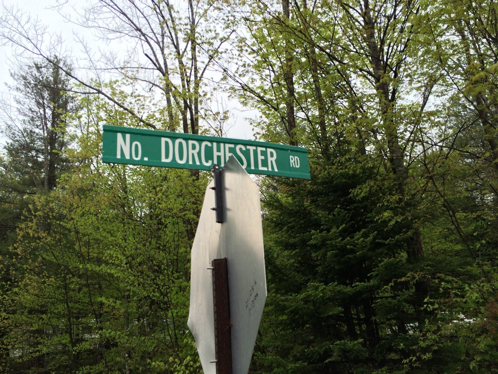
3. North Dorchester Rd
4a. Cummins Pond Road or
4b. An East-West road as viewed in Google Maps or
4c. Call my ride and cancel the trip
5. Cummins Pond to Dorchester Road
6. Dorchester Road to Lambert Ridge Trail on Smarts Mountain.
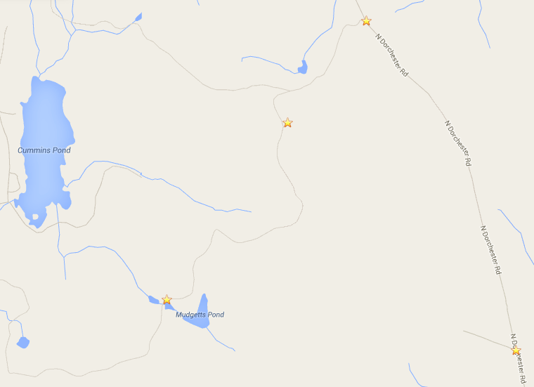
The information and maps describing lands West of North Dorchester Road is poor. Connecting North Dorchester Rd with Smarts Mountain seemed possible according to Google Maps and Bing Maps, but I couldn’t be sure. Cummins Pond Road, which leaves North Dorchester Road, seemed like a possibility for hiking. In addition, Google shows a road or trail leaving North Dorchester Road, a few miles North of Cummins Pond Road. Dorchester Road starts in Lyme at the Dartmouth Skiway, intersects the AT at Lambert Ridge Trail and ends as a class VI road at Cummins Pond, so connecting to that road seemed a logical choice for hiking. I estimated that this route would be between 20-22 miles depending on the road I took.
I decided to start my adventure the Friday before Memorial Day Weekend. Though the forecast called for rain, I wouldn’t need to be at a summit during the trip. I dropped off my car at the Dartmouth Skiway and my ride dropped me off at the Orange Cove Trail at Cardigan State Park at 10:30 AM.
Mt Cardigan North
I hiked North along the Orange Cove Trail, passing the obscured view of Firescrew and Cardigan from the Pond. At the intersection of Mowglis Trail and Orange Cove Trail, I started my GPS trace. At this junction, the Maskoma Trail - at one time - started its Northern ascent of Cataloochee Mountain towards Smarts Mountain. I kept straight, where Orange Cove Trail ended and Mowglis Trail North started.

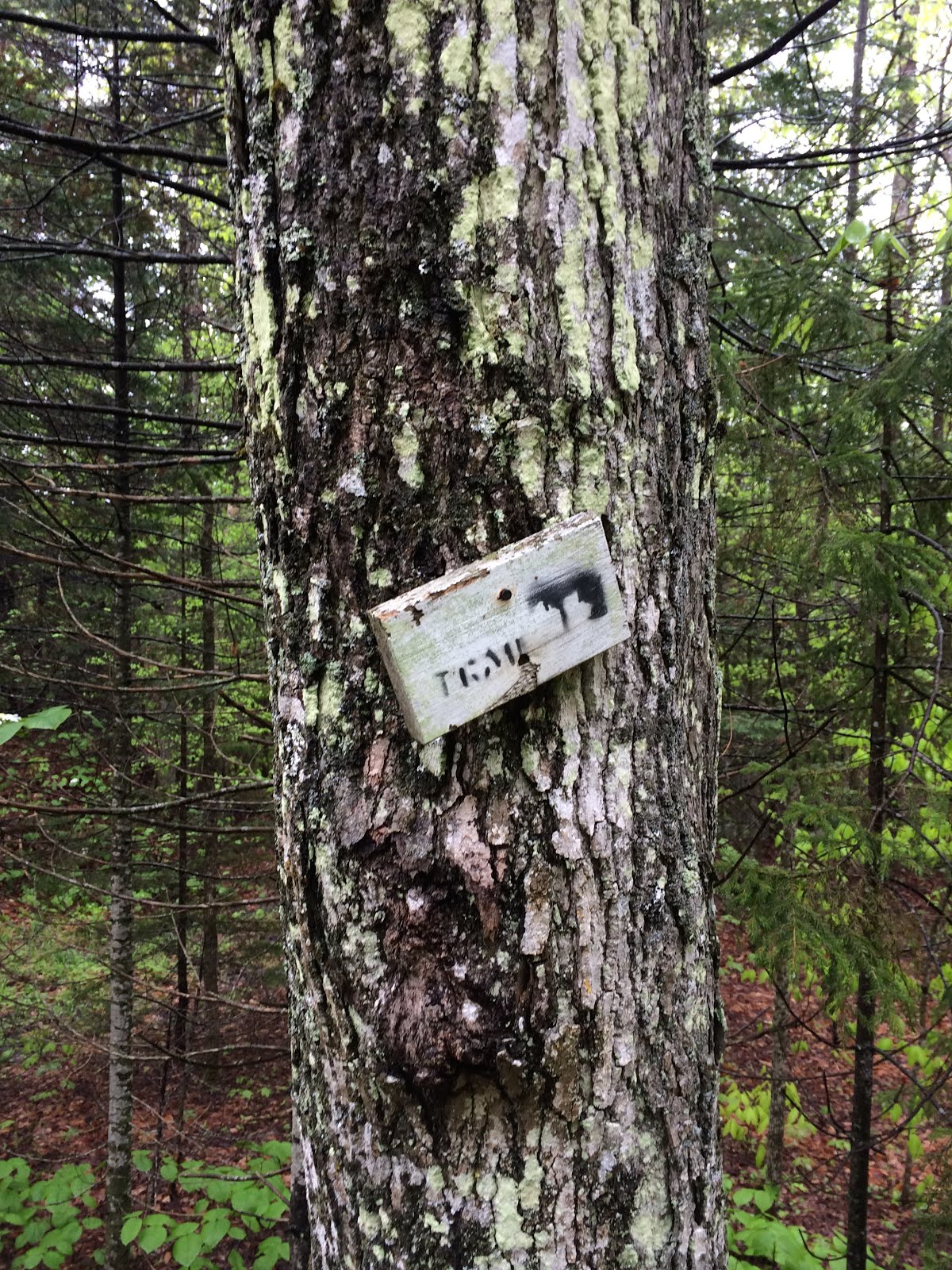
This trail was used as logging access at one point, and is still used by four wheelers and snowmobilers. Hidden behind some bushes and vegetation, you can still see small, old trail signs for the Mowglis Trail. Eventually the trail parallels the Atwell Brook and passes one driveway marked “private property.” I kept following the Mowglis Trail North.
 |  |
Province Road
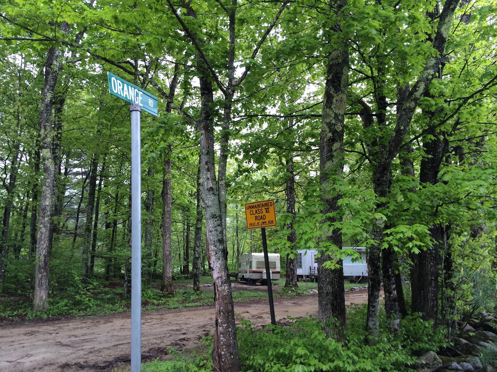
Eventually, the trail levels off and passes a farm on the left, where it meets Province Road. Here, the Mowglis Trail is labelled Orange Road, with a warning of it being a Class VI road. I followed Province Road West - left from the end of the Mowglis Trail. Province Road is beautiful. The road turns to dirt and narrows. Eventually, it follows a brook and passes a great cascade.

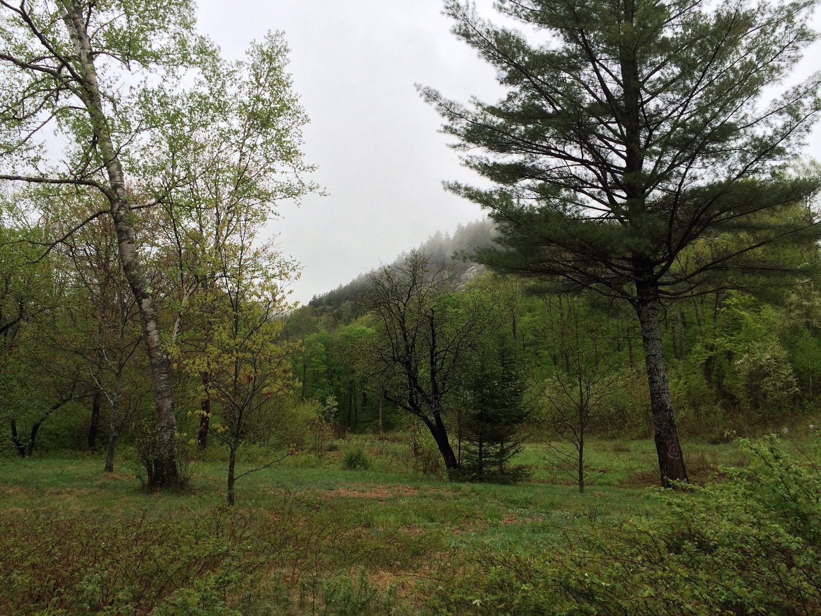
The road passes Province Road State Park, on the right. I imagine this park is rarely visited. Driving to it from NH-118 is impossible due to a bridge being out. Driving to it from the East would be bumpy to say the least. Before crossing the Dorchester town line, I saw a beautiful field and ledgy cliff. It’s definitely a nice part of Province State Park to visit for some climbing adventures.
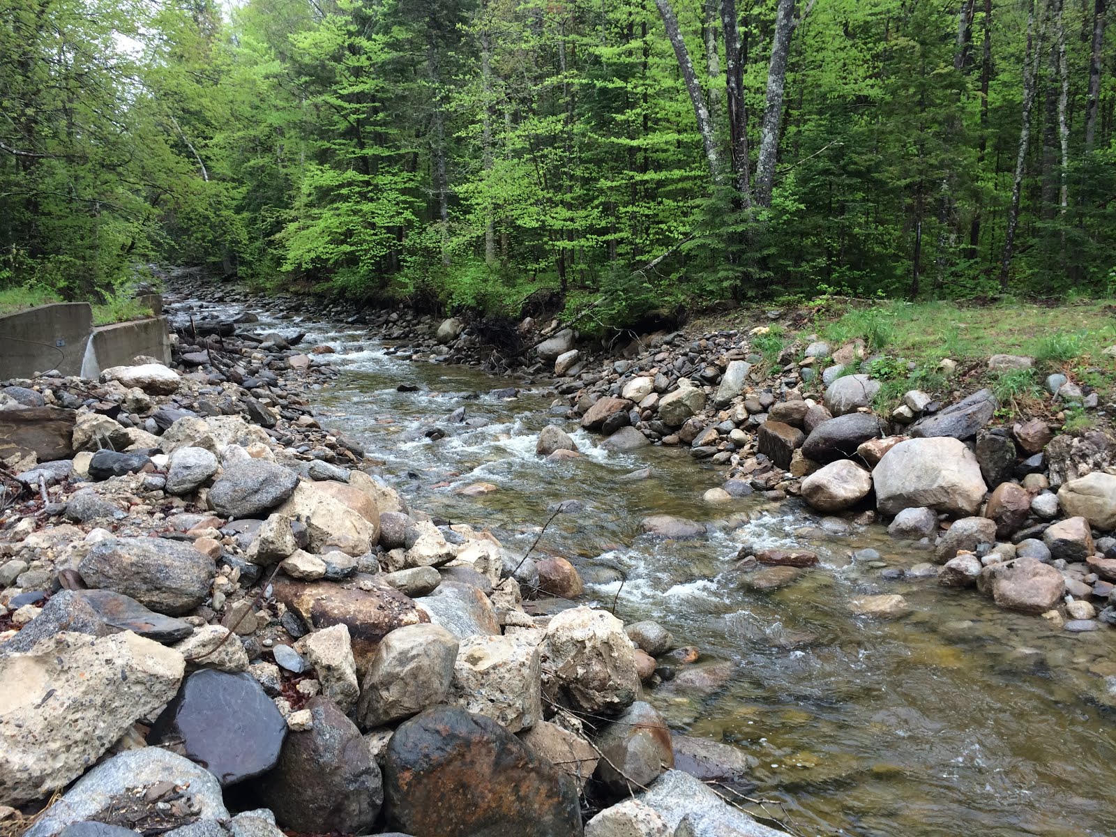
Next up was a part of the trip that concerned me the most: crossing the river where the bridge was missing. When I arrived, I found it was much easier to cross than I had anticipated. I handily rock-hopped across the river. I’ve experienced more difficult crossings in the Pemi Wilderness.
NH-118 and North Dorchester Road
I followed Province Road to its end, at NH-118. About 500 feet from the highway, I saw a Black Bear cross Province Road.

The time was 1:40 PM. From here, I walked a mile North, along NH-118 until I reached North Dorchester Road. I travelled along this muddy road until I reached Cummins Pond Road. I wasn’t able to properly scout this road earlier, as the town prohibits parking where it turns too narrow to drive further. I walked along Cummins Pond Road until it dead ended at a gate that looked private. I wasn’t chancing it. At this point it had started to rain, but it was very important to me to follow the rules, even if I was uncertain. I opted for plan “b” which meant backtracking and heading further North along North Dorchester Road to the other road that travelled to Cummins Pond.
Rain aside, the hike North was pleasant, but I like hiking dirt roads. I enjoyed my through hike of the Monadnock Sunapee Trail, and so far, this hike was similarly enjoyable. Eventually, the rain let up. At the height of land along the road, near a house that appeared abandoned, I caught a glimpse of Carr and maybe Moosilauke. I’m sure the view is spectacular on a clear day.
The Green Woodlands
The Green Woodlands
I approached the intersecting road, which connected North Dorchester Road to Cummins Pond. I hadn’t scouted this road previously, and if this road was not publicly accessible, I decided I would phone my ride, head home, and do more research.
According to a sign at the gate, it was indeed a trail and available to the public. The land is privately owned by the Green Woodlands, which protects 20,000 acres of land in Dorchester, Lyme, and Orford, including Cummins Pond. Their trails are open to the public. I decided to take them up on the invitation.
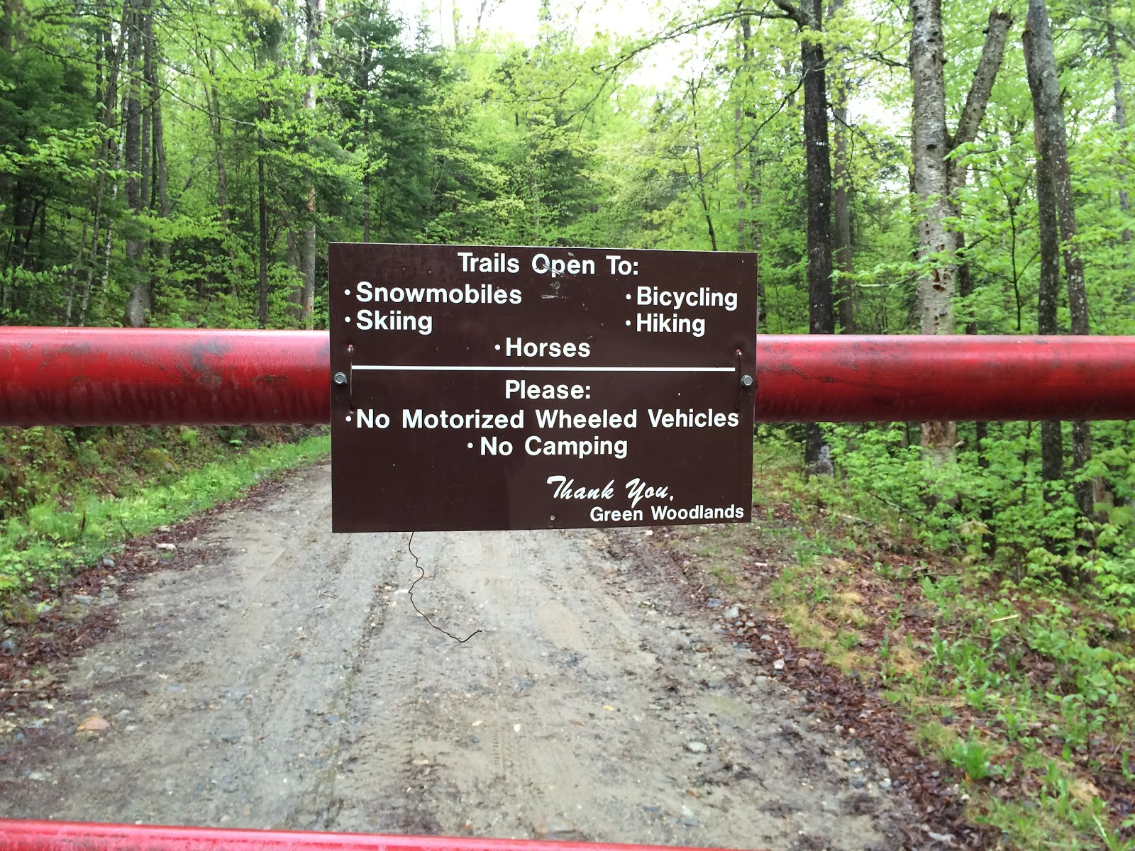
In my research over the past two years, I had visited their website, and they seemed very friendly. According to the information I read on the website, most trails in their network are unnamed and the trail system is not published. They keep the trails unnamed and unpublished to preserve the wild and obscure character of the property. Though the trail was easy enough to follow, I used the Google Map in my GPS as a guide.

This land is wilderness - fantastically beautiful, with dense forest, ponds, streams, and hills - moose and bear signs everywhere. I continued along the trail until it ended and another short path in the Green Woodlands network lead North to Cummins Pond. This trail crossed the start of the Mascoma River, where it begins at Cummins Pond. Rather than stop and view the pond, I decided to finish my journey by taking Dorchester Road, West, to the Appalachian Trail.
Dorchester Road, The Appalachian Trail, and Smarts Mountain
After a few miles on this class VI road, it widened to a dirt road. I passed a sign, indicating that the section of Dorchester Road I had just travelled was not maintained. Eventually, I passed into Lyme, near the shore of Reservoir Pond.

This part of Dorchester Road is very familiar to me. After a few miles of travel, I finally intersected the Appalachian Trail and continued to the Dartmouth Skiway, where I had left my car. Including the backtracking at Cummins Pond Road and the walk between the AT and the Skiway, the trip was 27 miles. I’d estimate that the trip between the Orange Cove Trail junction with Mowglis Trail and the intersection of Dorchester Road with Lambert Ridge Trail / AT is about 20 miles. I finished at 7:00 PM, so it took me about 8.5 hours.

Final Thoughts
This hike was fun. Province Road was beautiful, but surprisingly, the Green Woodlands was the highlight of the trip. Though, I’m not sure the way through the Green Woodlands I took - or maybe this property in general - was best. The Green Woodlands area is obscure, since trail maps are not published. I did hike North and then further South than I had initially wanted.
As I learned when hiking the Monadnock-Sunapee Trail, massive tracts of wilderness do exist in the West part of the State. Beautiful and long trails in the Western New Hampshire Highlands, maybe a Monadnock-Moosilauke Trail, could be created from existing, publicly accessible dirt roads and trails. This GPS trace shows my route.

Comments
Post a Comment